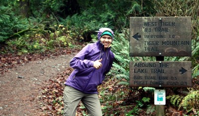
This particular weekend we woke up wanting to go for a hike, but without the motivation to drive out to the Cascades. So we settled on Tiger mountain, near Issaquah, both because of proximity and because the elevation changes meet our requirements of “a hike”. The trail head lies near another two past hikes, Poo Poo Point (don’t follow our winding route!), and Anti-Aircraft Ridge. We hiked all three, including Tiger #3, during mid-Fall. We must become homebodies as the daylight wanes. We set off on the standard West Tiger #3 trail from the trailhead, speeding through the flat, broad runway just west of the nature preserve. The trail quickly thinned off and we began a brisk climb up the face of Tiger. We passed many unmarked offshoots for the Cable Trail, but stuck to the primary trail. Despite being close to Seattle, the trail was near-empty and we enjoyed long patches of solitude. There was a thick fog that hugged the middle of the mountain and we spent half the hike moving through this gray mist.
The intersections with the Cable trail occurred more frequently near the top as both trails leveled off and began running near parallel. There was a small, abandoned camp to the right of the trails under the protection of some trees, about a hundred yards from the peak. Although banned, there is evidence that people camp here. The peak matched its description, and grew thick with evergreens. This old growth survived the logging boom, and differed mostly in denseness from the forest on the trail. The clearing provided a couple of rocks to rest and eat, and some friendly birds fluttered on the edges, flying in to eat bread from hikers.
We looped down using a different, unmaintained trail. It starts a couple hundred feet down the cable trail on the left. It’s not marked, but clear-trodden and descends quickly. The mud underfoot and persistent moisture from the fog made it slow going. We intersected another trail that led to Poo Poo Point, but continued our steep descent. Eventually we found the Notch Trail, which was wider, more level, and drained better. We picked up speed and quickly reached the nature preserve, as well as another motivation for choosing this hike: the abandoned bus. From there we quickly made it back to the car, with plenty of time for an early dinner.
Our loop around Tiger #3 revealed a small portion of the mountain. Supposedly, fifty miles of trails cross the face, including a trail, which we plan to do hike, that connects the three summits. The history of the mountain brings modern artifacts into the forest in odd, puzzling ways. This trail included the abandoned bus, but there are remnants of logging, mining and train crashes on other parts of the mountain. The trails will obviously clog in the warmer months, but while the winter cold and fog keep fair-weather hikers out, we’ll be back.
